 vesseltracker.com
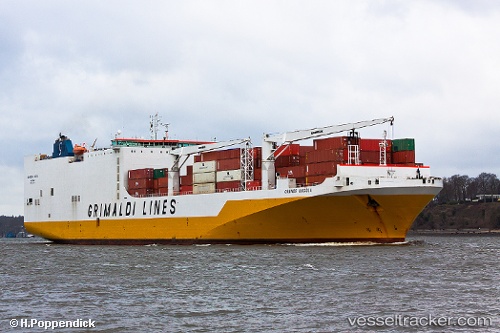
Vessel Grande Angola IMO: 9343156, MMSI: 247233800 Vehicles Carrier
UTC, 14.67465, -17.42567, course: 18, speed: 0
UTC, 14.67464, -17.42571, course: 18, speed: 0
2026-02-06 05:47:08 UTC, 14.67466, -17.42571, course: 18, speed: 0
Live AIS position:
UTC. Near Dakar),
updated 2026-02-06 05:47:08 UTC.
Find the position of the vessel Grande Angola on the map. The latter are known coordinates and path.
marine traffic ship tracker show on live map
The current position of vessel Grande Angola is 14.67466 lat / -17.42571 lng. Updated: 2026-02-06 05:47:08 UTCCurrently sailing under the flag of Italy
Grande Angola built in 2008 year
Deadweight:
26881 tDetails:
Last coordinates of the vessel:
UTC, 14.67465, -17.42568, course: 18, speed: 0UTC, 14.67465, -17.42567, course: 18, speed: 0
UTC, 14.67464, -17.42571, course: 18, speed: 0
2026-02-06 05:47:08 UTC, 14.67466, -17.42571, course: 18, speed: 0