 vesseltracker.com
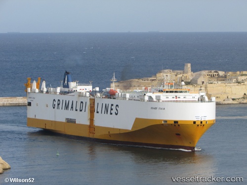
Vessel Grande Italia IMO: 9227912, MMSI: 247039300 Vehicles Carrier
UTC, 51.26951, 4.21180, course: 203, speed: 0
UTC, 51.26951, 4.21178, course: 203, speed: 0
2026-02-07 11:21:58 UTC, 51.26952, 4.21178, course: 203, speed: 0
Live AIS position:
UTC. Near Verrebroek),
updated 2026-02-07 11:21:58 UTC.
Find the position of the vessel Grande Italia on the map. The latter are known coordinates and path.
marine traffic ship tracker show on live map
The current position of vessel Grande Italia is 51.26952 lat / 4.21178 lng. Updated: 2026-02-07 11:21:58 UTCCurrently sailing under the flag of Italy
Grande Italia built in 2001 year
Deadweight:
12594 tDetails:
Last coordinates of the vessel:
UTC, 51.26952, 4.21178, course: 203, speed: 0UTC, 51.26951, 4.21180, course: 203, speed: 0
UTC, 51.26951, 4.21178, course: 203, speed: 0
2026-02-07 11:21:58 UTC, 51.26952, 4.21178, course: 203, speed: 0