 vesseltracker.com
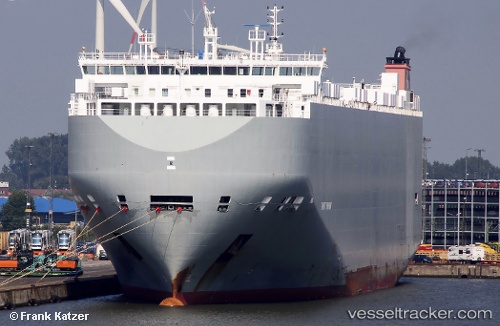
Vessel Gravity Highway IMO: 9672404, MMSI: 311000104 Vehicles Carrier
UTC, -6.72340, 39.51769, course: 87, speed: 1
UTC, -6.76115, 39.51512, course: 128, speed: 0.8
2026-02-07 02:23:26 UTC, -6.78168, 39.48357, course: 2, speed: 8.3
Live AIS position:
UTC. 12 nm E of Dar Es Salaam),
updated 2026-02-07 02:23:26 UTC.
Find the position of the vessel Gravity Highway on the map. The latter are known coordinates and path.
marine traffic ship tracker show on live map
The current position of vessel Gravity Highway is -6.78168 lat / 39.48357 lng. Updated: 2026-02-07 02:23:26 UTCCurrently sailing under the flag of Bahamas
Gravity Highway built in 2014 year
Deadweight:
19974 tDetails:
Last coordinates of the vessel:
UTC, -6.68744, 39.50917, course: 97, speed: 0.9UTC, -6.72340, 39.51769, course: 87, speed: 1
UTC, -6.76115, 39.51512, course: 128, speed: 0.8
2026-02-07 02:23:26 UTC, -6.78168, 39.48357, course: 2, speed: 8.3