 vesseltracker.com
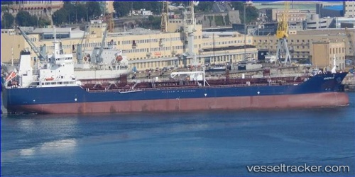
Vessel Greta K IMO: 9800374, MMSI: 249711000 Chemical Oil Products Tanker
UTC, 40.73395, -8.87267, course: 103, speed: 8.6
UTC, 40.64525, -8.75031, course: 81, speed: 9.1
2026-02-01 11:17:41 UTC, 40.65313, -8.72444, course: 263, speed: 0
Live AIS position:
UTC. Near Gafanha da Nazaré),
updated 2026-02-01 11:17:41 UTC.
Find the position of the vessel Greta K on the map. The latter are known coordinates and path.
marine traffic ship tracker show on live map
The current position of vessel Greta K is 40.65313 lat / -8.72444 lng. Updated: 2026-02-01 11:17:41 UTCCurrently sailing under the flag of Malta
Details:
Last coordinates of the vessel:
UTC, 40.75498, -8.88107, course: 283, speed: 3.1UTC, 40.73395, -8.87267, course: 103, speed: 8.6
UTC, 40.64525, -8.75031, course: 81, speed: 9.1
2026-02-01 11:17:41 UTC, 40.65313, -8.72444, course: 263, speed: 0