 vesseltracker.com
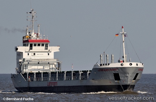
Vessel Griftbor IMO: 9116008, MMSI: 304050000 Multi Purpose Carrier
UTC, 57.59365, 9.97784, course: 132, speed: 0
UTC, 57.59366, 9.97785, course: 132, speed: 0
2026-02-01 07:30:54 UTC, 57.59366, 9.97786, course: 132, speed: 0
Live AIS position:
UTC. Near Hirtshals),
updated 2026-02-01 07:30:54 UTC.
Find the position of the vessel Griftbor on the map. The latter are known coordinates and path.
marine traffic ship tracker show on live map
The current position of vessel Griftbor is 57.59366 lat / 9.97786 lng. Updated: 2026-02-01 07:30:54 UTCCurrently sailing under the flag of Antigua Barbuda
Griftbor built in 1995 year
Deadweight:
4149 tDetails:
Last coordinates of the vessel:
UTC, 57.59366, 9.97781, course: 133, speed: 0UTC, 57.59365, 9.97784, course: 132, speed: 0
UTC, 57.59366, 9.97785, course: 132, speed: 0
2026-02-01 07:30:54 UTC, 57.59366, 9.97786, course: 132, speed: 0