 vesseltracker.com
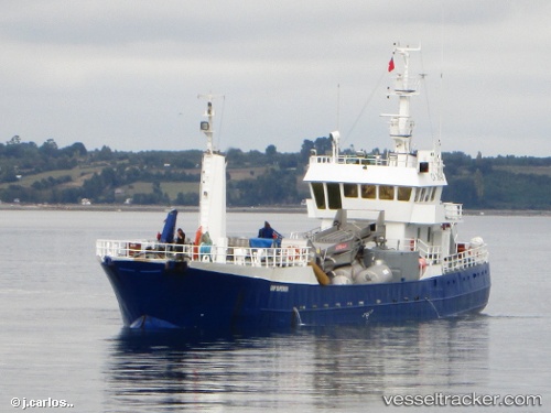
Vessel Grip Superior IMO: 8710003, MMSI: 725000938 Fishing Vessel
UTC, -41.48298, -72.95466, course: 246, speed: 0
UTC, -41.49593, -72.92330, course: 85, speed: 3.9
2026-02-01 17:30:57 UTC, -41.49072, -72.94649, course: 111, speed: 0.1
Live AIS position:
UTC. Near Puerto Montt),
updated 2026-02-01 17:30:57 UTC.
Find the position of the vessel Grip Superior on the map. The latter are known coordinates and path.
marine traffic ship tracker show on live map
The current position of vessel Grip Superior is -41.49072 lat / -72.94649 lng. Updated: 2026-02-01 17:30:57 UTCDetails:
Last coordinates of the vessel:
UTC, -41.48298, -72.95464, course: 247, speed: 0UTC, -41.48298, -72.95466, course: 246, speed: 0
UTC, -41.49593, -72.92330, course: 85, speed: 3.9
2026-02-01 17:30:57 UTC, -41.49072, -72.94649, course: 111, speed: 0.1