 vesseltracker.com
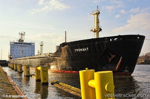
Vessel Grumant IMO: 9385879, MMSI: 273318940 Bulk Carrier
UTC, 38.87803, 26.96734, course: 41, speed: 0.1
UTC, 38.87801, 26.96742, course: 42, speed: 0.1
2026-03-14 07:55:31 UTC, 38.87795, 26.96783, course: 25, speed: 0
Live Vessel Grumant Analytics (details, animations, etc.)
Live AIS position: UTC. Near Aliaga), updated 2026-03-14 07:55:31 UTC.Find the position of the vessel Grumant on the map. The latter are known coordinates and path.
marine traffic ship tracker show on live map
The current position of vessel Grumant is 38.87795 lat / 26.96783 lng. Updated: 2026-03-14 07:55:31 UTCDetails:
Last coordinates of the vessel:
UTC, 38.87790, 26.96779, course: 26, speed: 0.1UTC, 38.87803, 26.96734, course: 41, speed: 0.1
UTC, 38.87801, 26.96742, course: 42, speed: 0.1
2026-03-14 07:55:31 UTC, 38.87795, 26.96783, course: 25, speed: 0