 vesseltracker.com
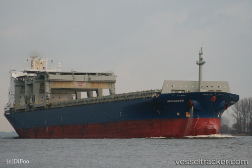
Vessel HERANGER IMO: 9079121, MMSI: 538009776 General Cargo Ship
UTC, 48.03512, -5.50676, course: 328, speed: 10.6
UTC, 48.18984, -5.60782, course: 330, speed: 9.7
2026-02-01 18:02:31 UTC, 48.59850, -5.74894, course: 25, speed: 10.2
Live AIS position:
UTC. 11 nm W of Ile D’Ouessant),
updated 2026-02-01 18:02:31 UTC.
Find the position of the vessel HERANGER on the map. The latter are known coordinates and path.
marine traffic ship tracker show on live map
The current position of vessel HERANGER is 48.59850 lat / -5.74894 lng. Updated: 2026-02-01 18:02:31 UTCCurrently sailing under the flag of Marshall Islands
HERANGER built in 1995 year
Deadweight:
50198 tDetails:
Last coordinates of the vessel:
UTC, 47.69591, -5.09239, course: 310, speed: 9.7UTC, 48.03512, -5.50676, course: 328, speed: 10.6
UTC, 48.18984, -5.60782, course: 330, speed: 9.7
2026-02-01 18:02:31 UTC, 48.59850, -5.74894, course: 25, speed: 10.2