 vesseltracker.com
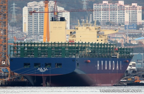
Vessel HYUNDAI EARTH IMO: 9725110, MMSI: 232024772 Container Ship
UTC, 28.43728, -119.62169, course: 125, speed: 13.8
UTC, 28.08592, -119.09223, course: 128, speed: 13.7
2026-03-01 07:44:01 UTC, 27.89237, -118.81278, course: 125, speed: 13.7
Live AIS position:
UTC. 191 nm W of Cedros Island),
updated 2026-03-01 07:44:01 UTC.
Find the position of the vessel HYUNDAI EARTH on the map. The latter are known coordinates and path.
marine traffic ship tracker show on live map
The current position of vessel HYUNDAI EARTH is 27.89237 lat / -118.81278 lng. Updated: 2026-03-01 07:44:01 UTCCurrently sailing under the flag of United Kingdom
HYUNDAI EARTH built in 2016 year
Deadweight:
124092 tDetails:
Last coordinates of the vessel:
UTC, 28.63423, -119.92415, course: 127, speed: 14UTC, 28.43728, -119.62169, course: 125, speed: 13.8
UTC, 28.08592, -119.09223, course: 128, speed: 13.7
2026-03-01 07:44:01 UTC, 27.89237, -118.81278, course: 125, speed: 13.7