 vesseltracker.com
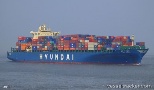
Vessel HYUNDAI JAKARTA IMO: 9323522, MMSI: 441398000 Container Ship
UTC, 26.90042, 121.80548, course: -1, speed: 16.3
UTC, 27.24152, 122.15625, course: 48, speed: 16.6
2026-03-01 09:03:41 UTC, 27.64708, 122.53300, course: 79, speed: 15.8
Live AIS position:
UTC. 55 nm SE of Wenling Longmen Port),
updated 2026-03-01 09:03:41 UTC.
Find the position of the vessel HYUNDAI JAKARTA on the map. The latter are known coordinates and path.
marine traffic ship tracker show on live map
The current position of vessel HYUNDAI JAKARTA is 27.64708 lat / 122.53300 lng. Updated: 2026-03-01 09:03:41 UTCCurrently sailing under the flag of Korea (Republic of)
HYUNDAI JAKARTA built in 2007 year
Deadweight:
80108 tDetails:
Last coordinates of the vessel:
UTC, 26.54407, 121.54325, course: -1, speed: 16.3UTC, 26.90042, 121.80548, course: -1, speed: 16.3
UTC, 27.24152, 122.15625, course: 48, speed: 16.6
2026-03-01 09:03:41 UTC, 27.64708, 122.53300, course: 79, speed: 15.8