 vesseltracker.com
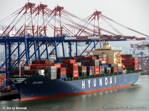
Vessel HYUNDAI OAKLAND IMO: 9385013, MMSI: 440062000 Container Ship
UTC, 51.94692, 4.04342, course: 258, speed: 0
UTC, 51.94702, 4.04353, course: 258, speed: 0
2026-02-09 10:23:14 UTC, 51.94693, 4.04328, course: 258, speed: 0
Live AIS position:
UTC. Near MAASVLAKTE - ROTTERDAM),
updated 2026-02-09 10:23:14 UTC.
Find the position of the vessel HYUNDAI OAKLAND on the map. The latter are known coordinates and path.
marine traffic ship tracker show on live map
The current position of vessel HYUNDAI OAKLAND is 51.94693 lat / 4.04328 lng. Updated: 2026-02-09 10:23:14 UTCCurrently sailing under the flag of Korea (Republic of)
HYUNDAI OAKLAND built in 2009 year
Deadweight:
72982 tDetails:
Last coordinates of the vessel:
UTC, 51.94685, 4.04342, course: 258, speed: 0UTC, 51.94692, 4.04342, course: 258, speed: 0
UTC, 51.94702, 4.04353, course: 258, speed: 0
2026-02-09 10:23:14 UTC, 51.94693, 4.04328, course: 258, speed: 0