 vesseltracker.com
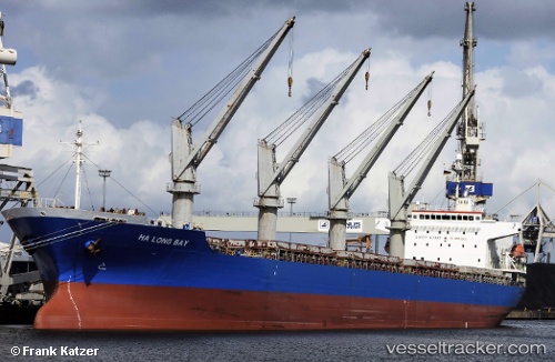
Vessel Ha Long Bay IMO: 9343625, MMSI: 235103287 Bulk Carrier
Live AIS position:
UTC. 22 nm SW of Captain Field),
updated 2025-03-31 01:19:01 UTC.
Find the position of the vessel Ha Long Bay on the map. The latter are known coordinates and path.
marine traffic ship tracker show on live map
The current position of vessel Ha Long Bay is 58.14518 lat / -2.36333 lng. Updated: 2025-03-31 01:19:01 UTCCurrently sailing under the flag of United Kingdom
Ha Long Bay built in 2007 year
Deadweight:
32311 tDetails:
Last coordinates of the vessel:
2025-03-31 01:19:01 UTC, 58.14518, -2.36333, course: 101, speed: 1.6