 vesseltracker.com
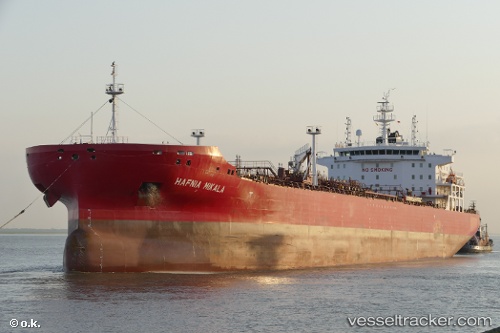
Vessel Hafnia Mikala IMO: 9732709, MMSI: 249836000 Chemical Oil Products Tanker
UTC, -12.13954, 157.29016, course: 147, speed: 13.4
UTC, -12.65028, 157.60046, course: 151, speed: 13.9
2026-02-18 13:58:16 UTC, -12.93500, 157.77058, course: 148, speed: 13.2
Live AIS position:
UTC. 154 nm SW of Bellona),
updated 2026-02-18 13:58:16 UTC.
Find the position of the vessel Hafnia Mikala on the map. The latter are known coordinates and path.
marine traffic ship tracker show on live map
The current position of vessel Hafnia Mikala is -12.93500 lat / 157.77058 lng. Updated: 2026-02-18 13:58:16 UTCCurrently sailing under the flag of
Hafnia Mikala built in 0 year
Deadweight:
0 tDetails:
Last coordinates of the vessel:
UTC, -11.70365, 157.02657, course: 148, speed: 13.6UTC, -12.13954, 157.29016, course: 147, speed: 13.4
UTC, -12.65028, 157.60046, course: 151, speed: 13.9
2026-02-18 13:58:16 UTC, -12.93500, 157.77058, course: 148, speed: 13.2