 vesseltracker.com
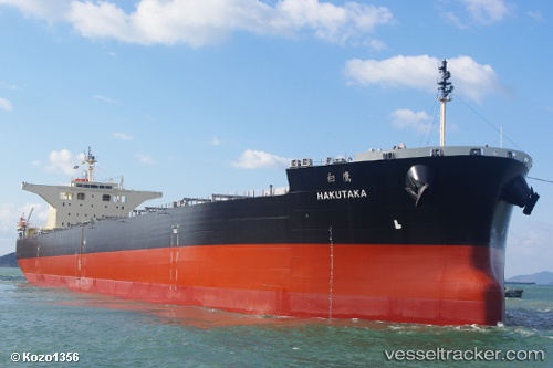
Vessel Hakutaka IMO: 9682851, MMSI: 636016898 Bulk Carrier
UTC, -5.79261, 153.57323, course: 178, speed: 13.8
UTC, -6.18647, 153.64919, course: 172, speed: 13.5
2026-01-30 23:53:55 UTC, -6.66853, 153.73317, course: 170, speed: 13.4
Live AIS position:
UTC. 112 nm W of Arawa),
updated 2026-01-30 23:53:55 UTC.
Find the position of the vessel Hakutaka on the map. The latter are known coordinates and path.
marine traffic ship tracker show on live map
The current position of vessel Hakutaka is -6.66853 lat / 153.73317 lng. Updated: 2026-01-30 23:53:55 UTCCurrently sailing under the flag of Liberia
Details:
Last coordinates of the vessel:
UTC, -5.22048, 153.48541, course: 175, speed: 13.3UTC, -5.79261, 153.57323, course: 178, speed: 13.8
UTC, -6.18647, 153.64919, course: 172, speed: 13.5
2026-01-30 23:53:55 UTC, -6.66853, 153.73317, course: 170, speed: 13.4