 vesseltracker.com
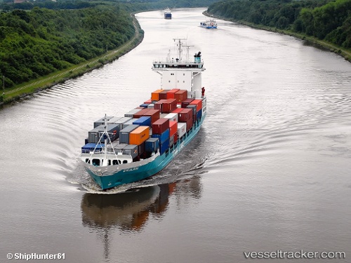
Vessel Hanni IMO: 9188506, MMSI: 211286440 Container Ship
UTC, 53.90166, 7.84567, course: 17, speed: 0.2
UTC, 53.90193, 7.84462, course: 37, speed: 0.3
2026-02-12 19:45:38 UTC, 53.90229, 7.84396, course: 59, speed: 0.3
Live AIS position:
UTC. Near Wangerooge),
updated 2026-02-12 19:45:38 UTC.
Find the position of the vessel Hanni on the map. The latter are known coordinates and path.
marine traffic ship tracker show on live map
The current position of vessel Hanni is 53.90229 lat / 7.84396 lng. Updated: 2026-02-12 19:45:38 UTCCurrently sailing under the flag of Germany
Hanni built in 1998 year
Deadweight:
6867 tDetails:
Last coordinates of the vessel:
UTC, 53.85641, 7.98226, course: 288, speed: 14.3UTC, 53.90166, 7.84567, course: 17, speed: 0.2
UTC, 53.90193, 7.84462, course: 37, speed: 0.3
2026-02-12 19:45:38 UTC, 53.90229, 7.84396, course: 59, speed: 0.3