 vesseltracker.com
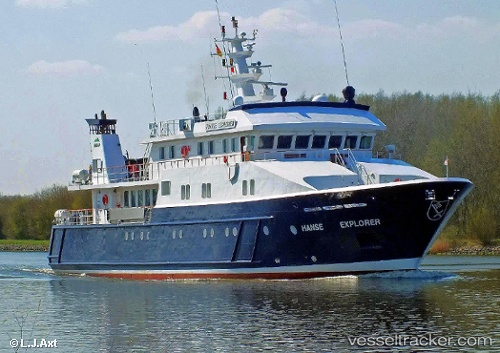
Vessel Hanse Explorer IMO: 9346110, MMSI: 304977000 Training Ship
UTC, -54.92815, -67.58941, course: 256, speed: 0.4
UTC, -54.92783, -67.58949, course: 233, speed: 0.2
2026-02-12 19:18:34 UTC, -54.92771, -67.58948, course: 220, speed: 0.4
Live AIS position:
UTC. Near Puerto Williams),
updated 2026-02-12 19:18:34 UTC.
Find the position of the vessel Hanse Explorer on the map. The latter are known coordinates and path.
marine traffic ship tracker show on live map
The current position of vessel Hanse Explorer is -54.92771 lat / -67.58948 lng. Updated: 2026-02-12 19:18:34 UTCCurrently sailing under the flag of Antigua Barbuda
Hanse Explorer built in 2006 year
Deadweight:
198 tDetails:
Last coordinates of the vessel:
UTC, -54.92760, -67.58987, course: 225, speed: 0.1UTC, -54.92815, -67.58941, course: 256, speed: 0.4
UTC, -54.92783, -67.58949, course: 233, speed: 0.2
2026-02-12 19:18:34 UTC, -54.92771, -67.58948, course: 220, speed: 0.4