 vesseltracker.com
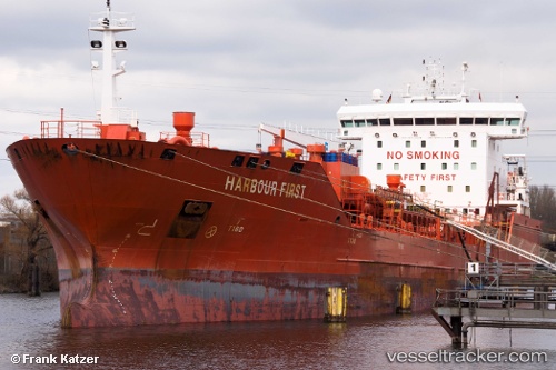
Vessel Harbour First IMO: 9473119, MMSI: 255804570 Chemical Oil Products Tanker
UTC, 60.51976, 27.16595, course: 341, speed: 0
UTC, 60.51978, 27.16595, course: 341, speed: 0
2026-02-11 06:34:37 UTC, 60.51983, 27.16590, course: 341, speed: 0
Live AIS position:
UTC. Near Lakulahti),
updated 2026-02-11 06:34:37 UTC.
Find the position of the vessel Harbour First on the map. The latter are known coordinates and path.
marine traffic ship tracker show on live map
The current position of vessel Harbour First is 60.51983 lat / 27.16590 lng. Updated: 2026-02-11 06:34:37 UTCCurrently sailing under the flag of Portugal
Harbour First built in 2011 year
Deadweight:
16894 tDetails:
Last coordinates of the vessel:
UTC, 60.36707, 27.20195, course: 55, speed: 7.5UTC, 60.51976, 27.16595, course: 341, speed: 0
UTC, 60.51978, 27.16595, course: 341, speed: 0
2026-02-11 06:34:37 UTC, 60.51983, 27.16590, course: 341, speed: 0