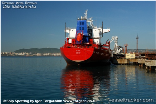
vessel Harcourt IMO: 9112131, Chemical Oil Products Tanker
vesseltracker.com
Vessel Harcourt IMO: 9112131, Chemical Oil Products Tanker
MMSI: 538005220 callsign: V7BZ4 size: 32x165

Find the position of the vessel Harcourt on the map. The latter are known coordinates and path.

marine traffic ship tracker show on live map

The current position of vessel Harcourt is 37.7391 lat / 174.78 lng. Updated: 2024-04-23 15:08:13 UTC
Port of registry:
Majuro (coral atoll, capital of the Marshall Islands)
Speed:
13 knot
Gross tonnage:
26218
Service entry:
1997-01-01T00:00:00Z
Details:


Last coordinates of the vessel:
UTC, 37.7391, 174.78, course: 0, speed: 20.4
2024-04-23 15:08:13 UTC, 37.7391, 174.78, course: 0, speed: 20.4

Track of the vessel in the last 14 days


Most frequent ports a vessels calls at Harcourt (538005220):

Singapore, traffic: 3
Al Aqabah, traffic: 1
Eilat, traffic: 1
Piraeus, traffic: 1
Salamis, traffic: 1
Sambu, traffic: 1

Link to the map:


Find another ship

Harcourt (538005220) last ports (portcalls and passsages)

Al Aqabah | 2024-01-25 06:23:56
Piraeus | 2022-12-23 14:18:35
Sambu | 2022-04-04 05:34:39
Singapore | 2021-12-04 02:38:44