 vesseltracker.com
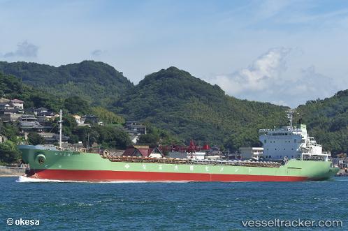
Vessel Harima Maru IMO: 9135119, MMSI: 431300387 Limestone Carrier
UTC, 32.72521, 132.70456, course: 109, speed: 12.6
UTC, 32.71061, 133.07001, course: 51, speed: 11.3
2026-02-10 19:58:21 UTC, 33.15125, 133.28638, course: 359, speed: 12.1
Live AIS position:
UTC. 10 nm NE of Saga),
updated 2026-02-10 19:58:21 UTC.
Find the position of the vessel Harima Maru on the map. The latter are known coordinates and path.
marine traffic ship tracker show on live map
The current position of vessel Harima Maru is 33.15125 lat / 133.28638 lng. Updated: 2026-02-10 19:58:21 UTCDetails:
Last coordinates of the vessel:
UTC, 32.94629, 132.35118, course: 141, speed: 11.4UTC, 32.72521, 132.70456, course: 109, speed: 12.6
UTC, 32.71061, 133.07001, course: 51, speed: 11.3
2026-02-10 19:58:21 UTC, 33.15125, 133.28638, course: 359, speed: 12.1