 vesseltracker.com
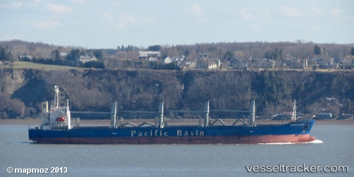
Vessel Harmony Ocean IMO: 9159749, MMSI: 351364000 Bulk Carrier
UTC, 1.46973, 146.48755, course: 141, speed: 11.7
UTC, 1.21162, 146.70070, course: 141, speed: 12.4
2026-02-10 11:18:02 UTC, 0.97318, 146.90657, course: 142, speed: 12.2
Live AIS position:
UTC. 183 nm N of Lombrum),
updated 2026-02-10 11:18:02 UTC.
Find the position of the vessel Harmony Ocean on the map. The latter are known coordinates and path.
marine traffic ship tracker show on live map
The current position of vessel Harmony Ocean is 0.97318 lat / 146.90657 lng. Updated: 2026-02-10 11:18:02 UTCDetails:
Last coordinates of the vessel:
UTC, 1.87008, 146.15837, course: 141, speed: 11.7UTC, 1.46973, 146.48755, course: 141, speed: 11.7
UTC, 1.21162, 146.70070, course: 141, speed: 12.4
2026-02-10 11:18:02 UTC, 0.97318, 146.90657, course: 142, speed: 12.2