 vesseltracker.com
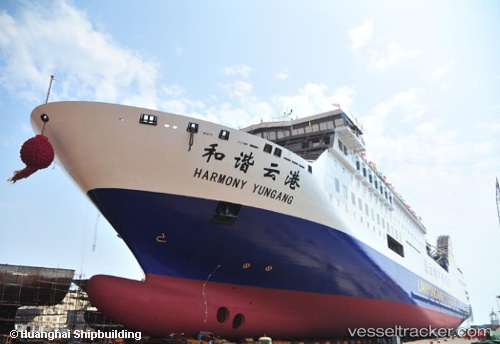
Vessel Harmony Yungang IMO: 9812810, MMSI: 352549000 Passenger Ro Ro Cargo Ship
UTC, 36.66423, 125.31994, course: 70, speed: 18.5
UTC, 36.95218, 126.09082, course: 55, speed: 17.1
2026-02-10 07:41:48 UTC, 37.34762, 126.51824, course: 52, speed: 16
Live AIS position:
UTC. Near Incheon),
updated 2026-02-10 07:41:48 UTC.
Find the position of the vessel Harmony Yungang on the map. The latter are known coordinates and path.
marine traffic ship tracker show on live map
The current position of vessel Harmony Yungang is 37.34762 lat / 126.51824 lng. Updated: 2026-02-10 07:41:48 UTCCurrently sailing under the flag of Panama
Details:
Last coordinates of the vessel:
UTC, 36.42539, 124.50679, course: 69, speed: 18.8UTC, 36.66423, 125.31994, course: 70, speed: 18.5
UTC, 36.95218, 126.09082, course: 55, speed: 17.1
2026-02-10 07:41:48 UTC, 37.34762, 126.51824, course: 52, speed: 16