 vesseltracker.com
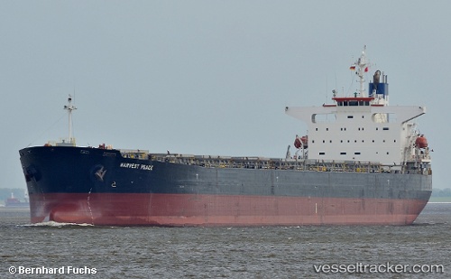
Vessel Harvest Peace IMO: 9267211, MMSI: 538004103 Bulk Carrier
UTC, 58.92314, -8.68819, course: -1, speed: 11.1
UTC, 58.55327, -9.04144, course: -1, speed: 11.2
2026-02-10 17:23:49 UTC, 58.10152, -9.44429, course: -1, speed: 11.4
Live AIS position:
UTC. 68 nm NW of Hougharry and Loch Eport),
updated 2026-02-10 17:23:49 UTC.
Find the position of the vessel Harvest Peace on the map. The latter are known coordinates and path.
marine traffic ship tracker show on live map
The current position of vessel Harvest Peace is 58.10152 lat / -9.44429 lng. Updated: 2026-02-10 17:23:49 UTCDetails:
Last coordinates of the vessel:
UTC, 59.10773, -8.50515, course: -1, speed: 11.3UTC, 58.92314, -8.68819, course: -1, speed: 11.1
UTC, 58.55327, -9.04144, course: -1, speed: 11.2
2026-02-10 17:23:49 UTC, 58.10152, -9.44429, course: -1, speed: 11.4