 vesseltracker.com
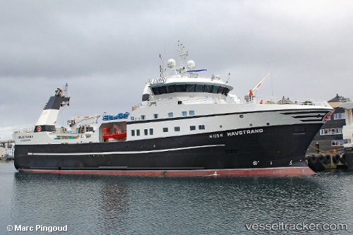
Vessel Havstrand IMO: 9639062, MMSI: 258732000 Fishing Vessel
UTC, 62.45196, 4.93819, course: 35, speed: 10.8
UTC, 62.59276, 4.85519, course: 6, speed: 2.7
2026-02-01 19:25:32 UTC, 62.65433, 4.84869, course: 350, speed: 3.1
Live AIS position:
UTC. 27 nm NW of Runde),
updated 2026-02-01 19:25:32 UTC.
Find the position of the vessel Havstrand on the map. The latter are known coordinates and path.
marine traffic ship tracker show on live map
The current position of vessel Havstrand is 62.65433 lat / 4.84869 lng. Updated: 2026-02-01 19:25:32 UTCCurrently sailing under the flag of Norway
Havstrand built in 2013 year
Deadweight:
1900 tDetails:
Last coordinates of the vessel:
UTC, 62.48490, 4.91021, course: 114, speed: 3.9UTC, 62.45196, 4.93819, course: 35, speed: 10.8
UTC, 62.59276, 4.85519, course: 6, speed: 2.7
2026-02-01 19:25:32 UTC, 62.65433, 4.84869, course: 350, speed: 3.1