 vesseltracker.com
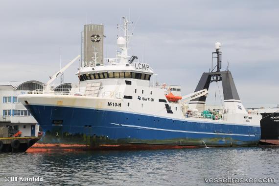
Vessel Havtind IMO: 9164304, MMSI: 259707000 Fishing Vessel
UTC, 70.99296, 25.12262, course: 261, speed: 4.2
UTC, 71.00048, 24.87581, course: 293, speed: 3.8
2026-02-01 11:26:06 UTC, 71.03307, 24.60271, course: 294, speed: 3
Live AIS position:
UTC. Near Havøysund),
updated 2026-02-01 11:26:06 UTC.
Find the position of the vessel Havtind on the map. The latter are known coordinates and path.
marine traffic ship tracker show on live map
The current position of vessel Havtind is 71.03307 lat / 24.60271 lng. Updated: 2026-02-01 11:26:06 UTCCurrently sailing under the flag of Norway
Havtind built in 1997 year
Deadweight:
700 tDetails:
Last coordinates of the vessel:
UTC, 70.92296, 25.61930, course: 256, speed: 3.7UTC, 70.99296, 25.12262, course: 261, speed: 4.2
UTC, 71.00048, 24.87581, course: 293, speed: 3.8
2026-02-01 11:26:06 UTC, 71.03307, 24.60271, course: 294, speed: 3