 vesseltracker.com
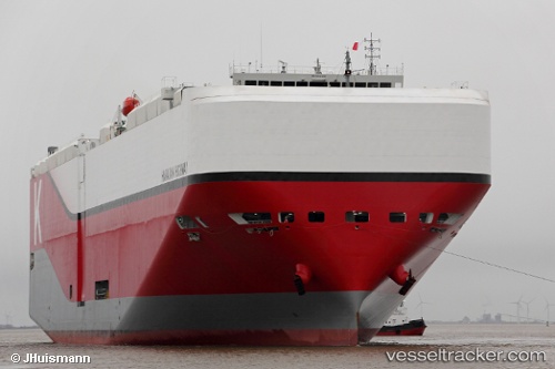
Vessel Hawaiian Highway IMO: 9712632, MMSI: 538006326 Vehicles Carrier
UTC, 34.33667, -45.93667, course: -1, speed: 12
UTC, 34.19167, -45.53167, course: -1, speed: 12
2026-01-30 16:16:12 UTC, 34.00333, -44.99333, course: -1, speed: 12
Live AIS position:
UTC. 130 nm NW of Girard),
updated 2026-01-30 16:16:12 UTC.
Find the position of the vessel Hawaiian Highway on the map. The latter are known coordinates and path.
marine traffic ship tracker show on live map
The current position of vessel Hawaiian Highway is 34.00333 lat / -44.99333 lng. Updated: 2026-01-30 16:16:12 UTCDetails:
Last coordinates of the vessel:
UTC, 34.57167, -46.60167, course: -1, speed: 15UTC, 34.33667, -45.93667, course: -1, speed: 12
UTC, 34.19167, -45.53167, course: -1, speed: 12
2026-01-30 16:16:12 UTC, 34.00333, -44.99333, course: -1, speed: 12