 vesseltracker.com
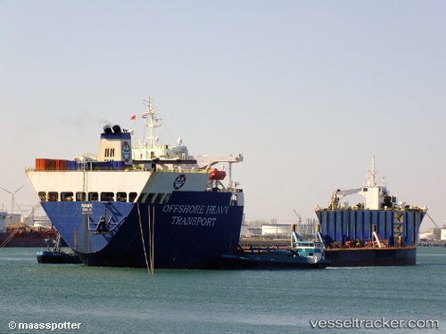
Vessel Hawk IMO: 8616556, MMSI: 259848000 Heavy Load Carrier
UTC, 1.52167, 54.31667, course: -1, speed: 13
UTC, 0.97667, 53.95500, course: -1, speed: 13
2026-01-31 01:21:24 UTC, 0.77833, 53.82667, course: -1, speed: 13
Live AIS position:
UTC. 325 nm N of Anse Kerlan),
updated 2026-01-31 01:21:24 UTC.
Find the position of the vessel Hawk on the map. The latter are known coordinates and path.
marine traffic ship tracker show on live map
The current position of vessel Hawk is 0.77833 lat / 53.82667 lng. Updated: 2026-01-31 01:21:24 UTCCurrently sailing under the flag of Norway
Hawk built in 1989 year
Deadweight:
53000 tDetails:
Last coordinates of the vessel:
UTC, 1.89333, 54.55333, course: -1, speed: 12UTC, 1.52167, 54.31667, course: -1, speed: 13
UTC, 0.97667, 53.95500, course: -1, speed: 13
2026-01-31 01:21:24 UTC, 0.77833, 53.82667, course: -1, speed: 13