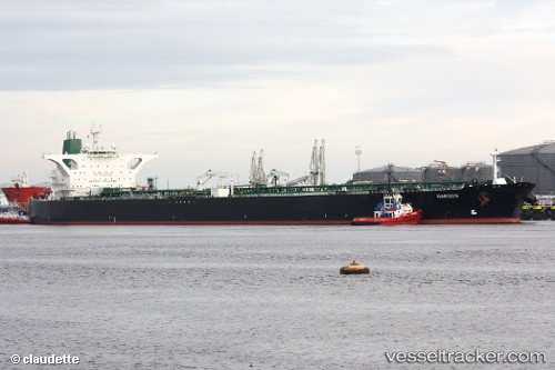
vessel Henna IMO: 9212929, Crude Oil Tanker
vesseltracker.com
Vessel Henna IMO: 9212929, Crude Oil Tanker
MMSI: 422222000 callsign: DDVQ2 size: 58x333

Find the position of the vessel Henna on the map. The latter are known coordinates and path.

marine traffic ship tracker show on live map

The current position of vessel Henna is 5.83665 lat / 80.7658 lng. Updated: 2025-07-17 06:32:58 UTC
Details:


Last coordinates of the vessel:
UTC, 5.862, 81.3486, course: 262, speed: 11.7
UTC, 5.85907, 81.1486, course: 262, speed: 12.3
UTC, 5.85266, 81.0408, course: 261, speed: 12.7
2025-07-17 06:32:58 UTC, 5.83665, 80.7658, course: 266, speed: 12.7

Track of the vessel in the last 14 days


Most frequent ports a vessels calls at Henna (422222000):

Nantong, traffic: 11
Sambu, traffic: 8
PENGERANG, traffic: 6
Singapore, traffic: 5
PULAU SAMBU, traffic: 4
BATU AMPAR, traffic: 4
TANAH MERAH, traffic: 4
BUKOM ISLAND, traffic: 3

Link to the map:


Find another ship

Henna (422222000) last ports (portcalls and passsages)

PULAU SAMBU | 2025-07-12 09:08:13
PENGERANG | 2025-07-12 07:43:43
PENGERANG | 2025-06-25 17:38:16
TANAH MERAH | 2025-06-25 17:12:37
BUKOM ISLAND | 2025-06-25 15:43:41
BUKOM ISLAND | 2025-05-13 11:00:32
BATU AMPAR | 2025-05-13 10:02:57
PENGERANG | 2025-05-13 08:16:46
PENGERANG | 2025-05-03 11:47:02
TANAH MERAH | 2025-05-03 10:05:06
Sambu | 2025-05-03 08:56:52
PULAU SAMBU | 2025-03-08 10:42:31
TANAH MERAH | 2025-03-08 09:52:20
PENGERANG | 2025-03-08 08:37:31
TANAH MERAH | 2025-02-25 15:21:11
BUKOM ISLAND | 2025-02-25 13:43:06
Nantong | 2025-02-13 08:09:15
Nantong | 2024-11-14 10:22:07
Singapore | 2024-10-01 07:22:29
Sambu | 2024-09-18 03:19:54
Sambu | 2024-07-26 06:56:47
Nantong | 2024-05-11 09:54:56
Nantong | 2024-05-07 09:36:36
Singapore | 2024-03-28 05:46:44
Sambu | 2024-03-28 05:29:52
Nantong | 2023-12-01 06:16:30
Nantong | 2023-11-22 08:11:04
Nantong | 2023-11-09 01:17:46
Nantong | 2023-11-01 02:23:17
Nantong | 2023-10-27 08:58:09
Nantong | 2023-10-23 03:59:41
Nantong | 2023-10-19 03:11:34