 vesseltracker.com
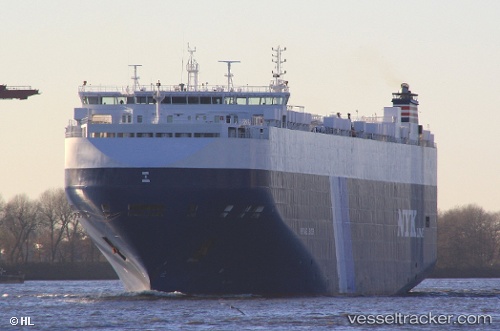
Vessel Heritage Leader IMO: 9441556, MMSI: 311040700 Vehicles Carrier
UTC, 31.04675, 131.24603, course: 55, speed: 12.9
UTC, 31.30598, 131.78951, course: 68, speed: 12.7
2026-01-30 03:51:29 UTC, 31.48333, 132.13834, course: -1, speed: 13
Live AIS position:
UTC. 38 nm E of ABURATSU),
updated 2026-01-30 03:51:29 UTC.
Find the position of the vessel Heritage Leader on the map. The latter are known coordinates and path.
marine traffic ship tracker show on live map
The current position of vessel Heritage Leader is 31.48333 lat / 132.13834 lng. Updated: 2026-01-30 03:51:29 UTCCurrently sailing under the flag of Bahamas
Heritage Leader built in 2011 year
Deadweight:
20434 tDetails:
Last coordinates of the vessel:
UTC, 30.88254, 130.89047, course: 55, speed: 12.7UTC, 31.04675, 131.24603, course: 55, speed: 12.9
UTC, 31.30598, 131.78951, course: 68, speed: 12.7
2026-01-30 03:51:29 UTC, 31.48333, 132.13834, course: -1, speed: 13