 vesseltracker.com
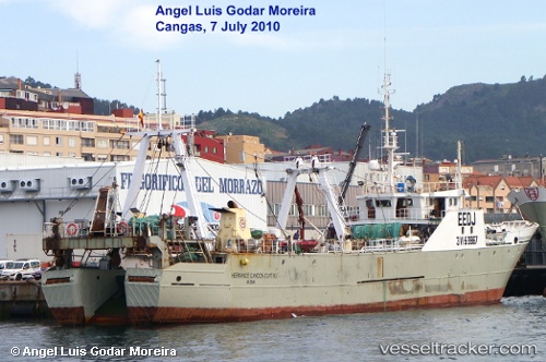
Vessel Hermanos Gandon 4 IMO: 8610801, MMSI: 224463000 Fishing Vessel
UTC, -46.34088, -60.84468, course: 186, speed: 4.4
UTC, -46.44500, -60.83167, course: -1, speed: 2
2026-01-30 00:00:11 UTC, -46.44500, -60.83167, course: -1, speed: 2
Live AIS position:
UTC. 222 nm E of Puerto Deseado),
updated 2026-01-30 00:00:11 UTC.
Find the position of the vessel Hermanos Gandon 4 on the map. The latter are known coordinates and path.
marine traffic ship tracker show on live map
The current position of vessel Hermanos Gandon 4 is -46.44500 lat / -60.83167 lng. Updated: 2026-01-30 00:00:11 UTCDetails:
Last coordinates of the vessel:
UTC, -46.34088, -60.84468, course: 186, speed: 4.4UTC, -46.34088, -60.84468, course: 186, speed: 4.4
UTC, -46.44500, -60.83167, course: -1, speed: 2
2026-01-30 00:00:11 UTC, -46.44500, -60.83167, course: -1, speed: 2