 vesseltracker.com
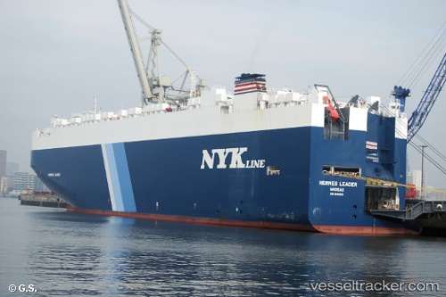
Vessel Hermes Leader IMO: 9690535, MMSI: 311000188 Vehicles Carrier
UTC, 34.49820, 137.08087, course: 335, speed: 9.8
UTC, 34.73500, 137.28333, course: -1, speed: 8
2026-01-29 22:07:02 UTC, 34.72150, 137.30128, course: 178, speed: 0
Live AIS position:
UTC. Near TOYOHASHI),
updated 2026-01-29 22:07:02 UTC.
Find the position of the vessel Hermes Leader on the map. The latter are known coordinates and path.
marine traffic ship tracker show on live map
The current position of vessel Hermes Leader is 34.72150 lat / 137.30128 lng. Updated: 2026-01-29 22:07:02 UTCCurrently sailing under the flag of Bahamas
Details:
Last coordinates of the vessel:
UTC, 34.18318, 137.13916, course: 341, speed: 7.2UTC, 34.49820, 137.08087, course: 335, speed: 9.8
UTC, 34.73500, 137.28333, course: -1, speed: 8
2026-01-29 22:07:02 UTC, 34.72150, 137.30128, course: 178, speed: 0