 vesseltracker.com
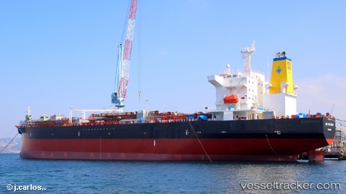
Vessel High Explorer IMO: 9788447, MMSI: 253000005 Chemical Oil Products Tanker
UTC, 21.31333, -157.88333, course: -1, speed: 0
UTC, 21.31333, -157.88333, course: -1, speed: 0
2026-02-01 15:19:29 UTC, 21.31333, -157.88333, course: -1, speed: 0
Live AIS position:
UTC. Near Honolulu),
updated 2026-02-01 15:19:29 UTC.
Find the position of the vessel High Explorer on the map. The latter are known coordinates and path.
marine traffic ship tracker show on live map
The current position of vessel High Explorer is 21.31333 lat / -157.88333 lng. Updated: 2026-02-01 15:19:29 UTCCurrently sailing under the flag of Luxembourg
High Explorer built in 0 year
Deadweight:
0 tDetails:
Last coordinates of the vessel:
UTC, 21.31413, -157.88487, course: 279, speed: 0UTC, 21.31333, -157.88333, course: -1, speed: 0
UTC, 21.31333, -157.88333, course: -1, speed: 0
2026-02-01 15:19:29 UTC, 21.31333, -157.88333, course: -1, speed: 0