 vesseltracker.com
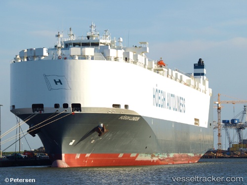
Vessel Hoegh London IMO: 9342205, MMSI: 258981000 Vehicles Carrier
UTC, 15.01171, -145.77470, course: 88, speed: 15.5
UTC, 15.02485, -145.30602, course: 85, speed: 15
2026-02-10 17:33:31 UTC, 15.04001, -144.92638, course: 88, speed: 15.2
Live AIS position:
UTC. 101 nm N of Santa Rita),
updated 2026-02-10 17:33:31 UTC.
Find the position of the vessel Hoegh London on the map. The latter are known coordinates and path.
marine traffic ship tracker show on live map
The current position of vessel Hoegh London is 15.04001 lat / -144.92638 lng. Updated: 2026-02-10 17:33:31 UTCDetails:
Last coordinates of the vessel:
UTC, 14.98099, -146.50243, course: 86, speed: 14.8UTC, 15.01171, -145.77470, course: 88, speed: 15.5
UTC, 15.02485, -145.30602, course: 85, speed: 15
2026-02-10 17:33:31 UTC, 15.04001, -144.92638, course: 88, speed: 15.2