 vesseltracker.com
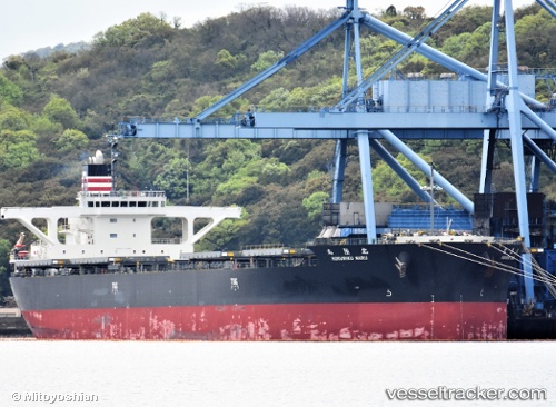
Vessel Hokuriku Maru IMO: 9658939, MMSI: 432957000 Bulk Carrier
UTC, 33.73167, 128.14333, course: -1, speed: 11
UTC, 33.38780, 128.22952, course: 175, speed: 12
2026-02-10 12:19:05 UTC, 32.78333, 128.34167, course: -1, speed: 12
Live AIS position:
UTC. 50 nm W of Ulju-gun/Ulsan),
updated 2026-02-10 12:19:05 UTC.
Find the position of the vessel Hokuriku Maru on the map. The latter are known coordinates and path.
marine traffic ship tracker show on live map
The current position of vessel Hokuriku Maru is 32.78333 lat / 128.34167 lng. Updated: 2026-02-10 12:19:05 UTCCurrently sailing under the flag of Japan
Details:
Last coordinates of the vessel:
UTC, 34.10155, 128.05852, course: 174, speed: 10.9UTC, 33.73167, 128.14333, course: -1, speed: 11
UTC, 33.38780, 128.22952, course: 175, speed: 12
2026-02-10 12:19:05 UTC, 32.78333, 128.34167, course: -1, speed: 12