 vesseltracker.com
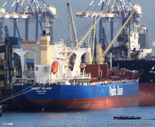
Vessel Honey Island IMO: 9755464, MMSI: 477669500 Bulk Carrier
Live AIS position:
UTC. Near Lianyungang),
updated 2025-11-18 05:13:59 UTC.
Find the position of the vessel Honey Island on the map. The latter are known coordinates and path.
marine traffic ship tracker show on live map
The current position of vessel Honey Island is 34.74077 lat / 119.46497 lng. Updated: 2025-11-18 05:13:59 UTCCurrently sailing under the flag of Hong Kong
Details:
Last coordinates of the vessel:
2025-11-18 05:13:59 UTC, 34.74077, 119.46497, course: 292, speed: 0