 vesseltracker.com
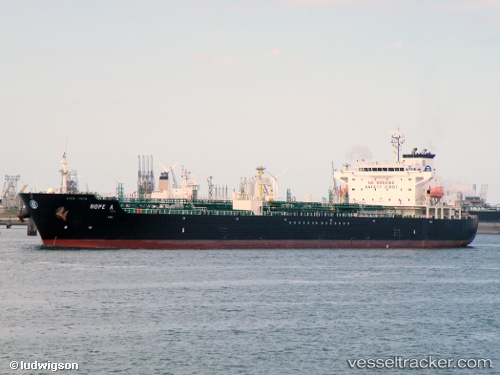
Vessel Hope A IMO: 9282821, MMSI: 215705000 Chemical Oil Products Tanker
UTC, 25.4689, 55.4832, course: 213, speed: 0
UTC, 25.4688, 55.4832, course: 213, speed: 0.1
2026-02-06 13:52:05 UTC, 25.4689, 55.4832, course: 213, speed: 0
Live AIS position:
UTC. Near HAMRIYA),
updated 2026-02-06 13:52:05 UTC.
Find the position of the vessel Hope A on the map. The latter are known coordinates and path.
marine traffic ship tracker show on live map
The current position of vessel Hope A is 25.4689 lat / 55.4832 lng. Updated: 2026-02-06 13:52:05 UTCCurrently sailing under the flag of Malta
Hope A built in 2004 year
Deadweight:
40095 tDetails:
Last coordinates of the vessel:
UTC, 25.4688, 55.4832, course: 212, speed: 0UTC, 25.4689, 55.4832, course: 213, speed: 0
UTC, 25.4688, 55.4832, course: 213, speed: 0.1
2026-02-06 13:52:05 UTC, 25.4689, 55.4832, course: 213, speed: 0