 vesseltracker.com
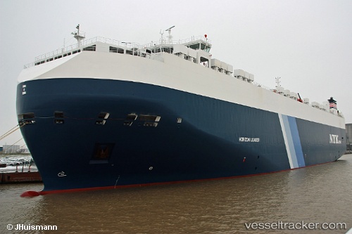
Vessel Horizon Leader IMO: 9441520, MMSI: 311040600 Vehicles Carrier
UTC, 28.76832, -139.50636, course: 281, speed: 13.4
UTC, 28.84282, -140.06393, course: 280, speed: 13.3
2026-03-02 01:29:17 UTC, 28.88827, -140.36482, course: 279, speed: 13.6
Live AIS position:
UTC. Open sea, approx. 401 nm off the nearest listed port),
updated 2026-03-02 01:29:17 UTC.
Find the position of the vessel Horizon Leader on the map. The latter are known coordinates and path.
marine traffic ship tracker show on live map
The current position of vessel Horizon Leader is 28.88827 lat / -140.36482 lng. Updated: 2026-03-02 01:29:17 UTCCurrently sailing under the flag of Bahamas
Horizon Leader built in 2010 year
Deadweight:
20434 tDetails:
Last coordinates of the vessel:
UTC, 28.68833, -138.94667, course: -1, speed: 13UTC, 28.76832, -139.50636, course: 281, speed: 13.4
UTC, 28.84282, -140.06393, course: 280, speed: 13.3
2026-03-02 01:29:17 UTC, 28.88827, -140.36482, course: 279, speed: 13.6