 vesseltracker.com
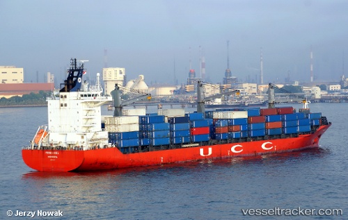
Vessel Hsl Portsmouth IMO: 9302437, MMSI: 636018192 Container Ship
UTC, 8.47667, -13.53933, course: 266, speed: 0.1
UTC, 8.47617, -13.53933, course: 278, speed: 0.1
2026-02-08 23:33:50 UTC, 8.47517, -13.53983, course: 312, speed: 0.1
Live AIS position:
UTC. 18 nm W of NASSIT),
updated 2026-02-08 23:33:50 UTC.
Find the position of the vessel Hsl Portsmouth on the map. The latter are known coordinates and path.
marine traffic ship tracker show on live map
The current position of vessel Hsl Portsmouth is 8.47517 lat / -13.53983 lng. Updated: 2026-02-08 23:33:50 UTCCurrently sailing under the flag of Liberia
Hsl Portsmouth built in 2004 year
Deadweight:
33847 tDetails:
Last coordinates of the vessel:
UTC, 8.47550, -13.53967, course: 305, speed: 0.2UTC, 8.47667, -13.53933, course: 266, speed: 0.1
UTC, 8.47617, -13.53933, course: 278, speed: 0.1
2026-02-08 23:33:50 UTC, 8.47517, -13.53983, course: 312, speed: 0.1