 vesseltracker.com
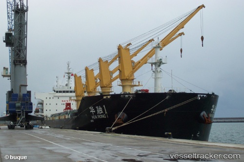
Vessel Hua Rong 1 IMO: 9650456, MMSI: 414119000 Bulk Carrier
UTC, 15.80333, 119.54167, course: -1, speed: 9
UTC, 15.90946, 119.52447, course: 359, speed: 9.7
2026-02-10 22:08:29 UTC, 16.39167, 119.45500, course: -1, speed: 9
Live AIS position:
UTC. 25 nm W of Bolinao),
updated 2026-02-10 22:08:29 UTC.
Find the position of the vessel Hua Rong 1 on the map. The latter are known coordinates and path.
marine traffic ship tracker show on live map
The current position of vessel Hua Rong 1 is 16.39167 lat / 119.45500 lng. Updated: 2026-02-10 22:08:29 UTCCurrently sailing under the flag of China
Hua Rong 1 built in 2012 year
Deadweight:
56381 tDetails:
Last coordinates of the vessel:
UTC, 15.35593, 119.59727, course: 357, speed: 8.7UTC, 15.80333, 119.54167, course: -1, speed: 9
UTC, 15.90946, 119.52447, course: 359, speed: 9.7
2026-02-10 22:08:29 UTC, 16.39167, 119.45500, course: -1, speed: 9