 vesseltracker.com
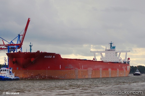
Vessel Hugo N IMO: 9398096, MMSI: 636014330 Ore Carrier
UTC, -44.00982, 51.55728, course: 0, speed: 68.1
UTC, -44.00982, 51.55728, course: 0, speed: 68.1
2026-02-02 21:49:57 UTC, -44.00982, 51.55728, course: 0, speed: 68.1
Live AIS position:
UTC. Open sea (no nearby ports in database)),
updated 2026-02-02 21:49:57 UTC.
Find the position of the vessel Hugo N on the map. The latter are known coordinates and path.
marine traffic ship tracker show on live map
The current position of vessel Hugo N is -44.00982 lat / 51.55728 lng. Updated: 2026-02-02 21:49:57 UTCDetails:
Last coordinates of the vessel:
UTC, 33.26977, -18.78492, course: 14, speed: 67.5UTC, -44.00982, 51.55728, course: 0, speed: 68.1
UTC, -44.00982, 51.55728, course: 0, speed: 68.1
2026-02-02 21:49:57 UTC, -44.00982, 51.55728, course: 0, speed: 68.1