 vesseltracker.com
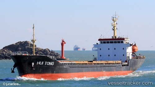
Vessel Hui Tong IMO: 9537599, MMSI: 370672000 General Cargo Ship
UTC, 37.86333, 138.43167, course: -1, speed: 0
UTC, 37.86333, 138.43167, course: -1, speed: 0
2026-02-07 11:15:25 UTC, 37.86167, 138.43167, course: -1, speed: 0
Live AIS position:
UTC. 12 nm S of Sado Shima Apt),
updated 2026-02-07 11:15:25 UTC.
Find the position of the vessel Hui Tong on the map. The latter are known coordinates and path.
marine traffic ship tracker show on live map
The current position of vessel Hui Tong is 37.86167 lat / 138.43167 lng. Updated: 2026-02-07 11:15:25 UTCCurrently sailing under the flag of Panama
Details:
Last coordinates of the vessel:
UTC, 37.86167, 138.43167, course: -1, speed: 0UTC, 37.86333, 138.43167, course: -1, speed: 0
UTC, 37.86333, 138.43167, course: -1, speed: 0
2026-02-07 11:15:25 UTC, 37.86167, 138.43167, course: -1, speed: 0