 vesseltracker.com
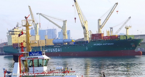
Vessel Hyundai Antwerp IMO: 9469912, MMSI: 538004416 Multi Purpose Carrier
UTC, 13.22500, 69.13500, course: -1, speed: 13
UTC, 12.81833, 69.47833, course: -1, speed: 13
2026-03-01 23:37:02 UTC, 12.58667, 69.67333, course: -1, speed: 12
Live AIS position:
UTC. 180 nm NE of Tinaquillo),
updated 2026-03-01 23:37:02 UTC.
Find the position of the vessel Hyundai Antwerp on the map. The latter are known coordinates and path.
marine traffic ship tracker show on live map
The current position of vessel Hyundai Antwerp is 12.58667 lat / 69.67333 lng. Updated: 2026-03-01 23:37:02 UTCDetails:
Last coordinates of the vessel:
UTC, 13.47667, 68.92167, course: -1, speed: 12UTC, 13.22500, 69.13500, course: -1, speed: 13
UTC, 12.81833, 69.47833, course: -1, speed: 13
2026-03-01 23:37:02 UTC, 12.58667, 69.67333, course: -1, speed: 12