 vesseltracker.com
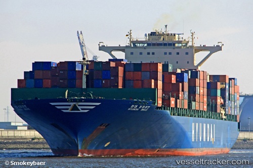
Vessel Hyundai Brave IMO: 9346304, MMSI: 538007477 Container Ship
UTC, 22.25365, 114.65583, course: 166, speed: 1.1
UTC, 22.14335, 114.50388, course: 259, speed: 11.6
2026-03-01 10:13:53 UTC, 22.24872, 114.12477, course: 323, speed: 15
Live AIS position:
UTC. Near Pok Fu Lam),
updated 2026-03-01 10:13:53 UTC.
Find the position of the vessel Hyundai Brave on the map. The latter are known coordinates and path.
marine traffic ship tracker show on live map
The current position of vessel Hyundai Brave is 22.24872 lat / 114.12477 lng. Updated: 2026-03-01 10:13:53 UTCCurrently sailing under the flag of Marshall Is
Hyundai Brave built in 2007 year
Deadweight:
99123 tDetails:
Last coordinates of the vessel:
UTC, 22.25685, 114.68967, course: 90, speed: 1UTC, 22.25365, 114.65583, course: 166, speed: 1.1
UTC, 22.14335, 114.50388, course: 259, speed: 11.6
2026-03-01 10:13:53 UTC, 22.24872, 114.12477, course: 323, speed: 15