 vesseltracker.com
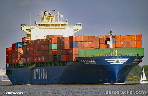
Vessel Hyundai Dynasty IMO: 9347578, MMSI: 538007485 Container Ship
UTC, -19.51966, 64.98453, course: 54, speed: 18
UTC, -19.16594, 65.45940, course: 53, speed: 18.2
2026-03-01 06:07:21 UTC, -18.66195, 66.12811, course: 53, speed: 18.2
Live AIS position:
UTC. 166 nm E of Port Mathurin),
updated 2026-03-01 06:07:21 UTC.
Find the position of the vessel Hyundai Dynasty on the map. The latter are known coordinates and path.
marine traffic ship tracker show on live map
The current position of vessel Hyundai Dynasty is -18.66195 lat / 66.12811 lng. Updated: 2026-03-01 06:07:21 UTCCurrently sailing under the flag of Marshall Is
Hyundai Dynasty built in 2007 year
Deadweight:
63254 tDetails:
Last coordinates of the vessel:
UTC, -19.77269, 64.64087, course: 53, speed: 18.3UTC, -19.51966, 64.98453, course: 54, speed: 18
UTC, -19.16594, 65.45940, course: 53, speed: 18.2
2026-03-01 06:07:21 UTC, -18.66195, 66.12811, course: 53, speed: 18.2