 vesseltracker.com
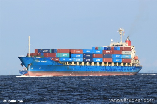
Vessel Hyundai Harmony IMO: 9276406, MMSI: 355033000 Container Ship
UTC, 3.30404, 112.92043, course: -1, speed: 0
UTC, 3.30412, 112.92055, course: -1, speed: 0
2026-03-01 15:31:53 UTC, 3.30398, 112.92024, course: -1, speed: 0
Live AIS position:
UTC. Near BINTULU),
updated 2026-03-01 15:31:53 UTC.
Find the position of the vessel Hyundai Harmony on the map. The latter are known coordinates and path.
marine traffic ship tracker show on live map
The current position of vessel Hyundai Harmony is 3.30398 lat / 112.92024 lng. Updated: 2026-03-01 15:31:53 UTCCurrently sailing under the flag of Panama
Hyundai Harmony built in 2002 year
Deadweight:
18002 tDetails:
Last coordinates of the vessel:
UTC, 3.30436, 112.92081, course: -1, speed: 0UTC, 3.30404, 112.92043, course: -1, speed: 0
UTC, 3.30412, 112.92055, course: -1, speed: 0
2026-03-01 15:31:53 UTC, 3.30398, 112.92024, course: -1, speed: 0