 vesseltracker.com
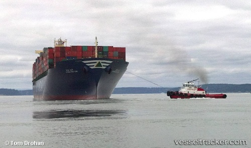
Vessel Hyundai New York IMO: 9385025, MMSI: 566999000 Container Ship
UTC, 31.17203, 122.60120, course: 121, speed: 0.2
UTC, 31.17278, 122.60233, course: 141, speed: 0
2026-03-01 04:00:34 UTC, 31.17197, 122.60613, course: 212, speed: 0.1
Live AIS position:
UTC. 12 nm NE of Jingjiang),
updated 2026-03-01 04:00:34 UTC.
Find the position of the vessel Hyundai New York on the map. The latter are known coordinates and path.
marine traffic ship tracker show on live map
The current position of vessel Hyundai New York is 31.17197 lat / 122.60613 lng. Updated: 2026-03-01 04:00:34 UTCDetails:
Last coordinates of the vessel:
UTC, 31.17008, 122.60085, course: -1, speed: 0UTC, 31.17203, 122.60120, course: 121, speed: 0.2
UTC, 31.17278, 122.60233, course: 141, speed: 0
2026-03-01 04:00:34 UTC, 31.17197, 122.60613, course: 212, speed: 0.1