.
vessel 636020912 IMO: 9321718, vesseltracker.com
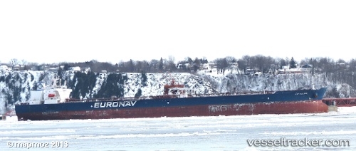
Vessel 636020912 IMO: 9321718, MMSI: 636020912

callsign:
size: x

Live AIS position: UTC. 27 nm N of Halul Island), updated 2026-02-03 21:44:46 UTC.

Find the position of the vessel 636020912 on the map. The latter are known coordinates and path.

marine traffic ship tracker show on live map

The current position of vessel 636020912 is 26.11306 lat / 52.32134 lng. Updated: 2026-02-03 21:44:46 UTC
Details:


Last coordinates of the vessel:
UTC, 26.11306, 52.32134, course: 72, speed: 7.4
2026-02-03 21:44:46 UTC, 26.11306, 52.32134, course: 72, speed: 7.4

Track of the vessel in the last 28 days


Most frequent ports a vessels calls at 636020912 (636020912):

Algeciras, traffic: 5
Sambu, traffic: 4
Incheon, traffic: 3
Benicia, traffic: 2
San Francisco, traffic: 2
Singapore, traffic: 2
Pointe Noire, traffic: 2
SLUISKIL, traffic: 1
Salvador, traffic: 1
TANAH MERAH, traffic: 1
Colon, traffic: 1
Cristobal, traffic: 1
Galveston, traffic: 1
Skaramangas, traffic: 1
Terneuzen, traffic: 1

Link to the map:


Find another ship

636020912 (636020912) last ports (portcalls and passsages)

Cai Mep | 2025-08-31 15:02:26
SLUISKIL | 2025-08-12 03:19:43
Galveston | 2025-06-21 20:48:47
TANAH MERAH | 2025-06-04 16:57:02
Skaramangas | 2022-12-09 09:13:23
Algeciras | 2022-10-13 10:26:15
Algeciras | 2022-10-08 04:22:15
Algeciras | 2022-10-04 01:57:13
Algeciras | 2022-09-30 01:24:38
Algeciras | 2022-09-25 13:34:29
Salvador | 2022-08-28 01:12:21
Pointe Noire | 2022-08-04 22:51:51
Incheon | 2022-06-12 07:42:37
Tsugaru-Kaikyo | 2022-06-07 16:20:10
Panama | 2022-05-13 23:06:38
Cristobal | 2022-05-12 22:30:24
Los Angeles | 2022-04-11 03:55:48
Benicia | 2022-04-06 12:36:04
San Francisco | 2022-04-06 10:05:05
Singapore | 2022-01-13 09:50:18
Sambu | 2022-01-12 07:35:00
Incheon | 2021-12-28 02:40:27