 vesseltracker.com
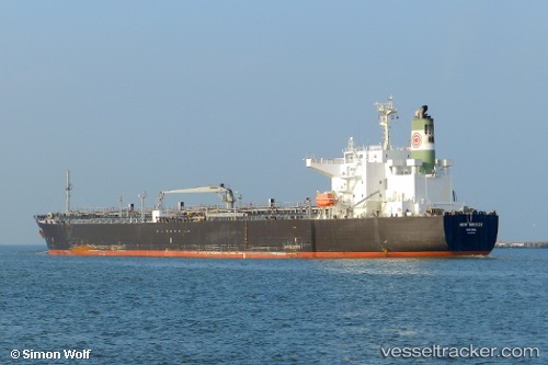
Vessel IMPERIOUS IMO: 9561382, MMSI: 538009584 Oil Products Tanker
UTC, -14.58943, 41.65517, course: 24, speed: 12.9
UTC, -14.21935, 41.83660, course: 24, speed: 13.2
2026-02-05 21:52:33 UTC, -13.86685, 41.99803, course: 24, speed: 13.1
Live AIS position:
UTC. 88 nm NE of NACALA PORTO),
updated 2026-02-05 21:52:33 UTC.
Find the position of the vessel IMPERIOUS on the map. The latter are known coordinates and path.
marine traffic ship tracker show on live map
The current position of vessel IMPERIOUS is -13.86685 lat / 41.99803 lng. Updated: 2026-02-05 21:52:33 UTCCurrently sailing under the flag of Marshall Islands
IMPERIOUS built in 2010 year
Deadweight:
48064 tDetails:
Last coordinates of the vessel:
UTC, -14.97268, 41.47952, course: 30, speed: 12UTC, -14.58943, 41.65517, course: 24, speed: 12.9
UTC, -14.21935, 41.83660, course: 24, speed: 13.2
2026-02-05 21:52:33 UTC, -13.86685, 41.99803, course: 24, speed: 13.1