 vesseltracker.com
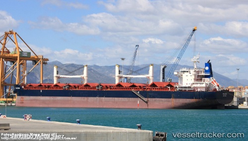
Vessel INGWAR SELMER IMO: 9490818, MMSI: 538009867 Bulk Carrier
UTC, 3.94978, 100.21015, course: 150, speed: 12.4
UTC, 3.60277, 100.41913, course: 151, speed: 11.8
2026-02-04 00:11:21 UTC, 3.15773, 100.62283, course: 141, speed: 9.8
Live AIS position:
UTC. 28 nm W of Kuala Selangor),
updated 2026-02-04 00:11:21 UTC.
Find the position of the vessel INGWAR SELMER on the map. The latter are known coordinates and path.
marine traffic ship tracker show on live map
The current position of vessel INGWAR SELMER is 3.15773 lat / 100.62283 lng. Updated: 2026-02-04 00:11:21 UTCCurrently sailing under the flag of Marshall Islands
INGWAR SELMER built in 2011 year
Deadweight:
58018 tDetails:
Last coordinates of the vessel:
UTC, 4.20380, 100.04670, course: 152, speed: 11.8UTC, 3.94978, 100.21015, course: 150, speed: 12.4
UTC, 3.60277, 100.41913, course: 151, speed: 11.8
2026-02-04 00:11:21 UTC, 3.15773, 100.62283, course: 141, speed: 9.8