 vesseltracker.com
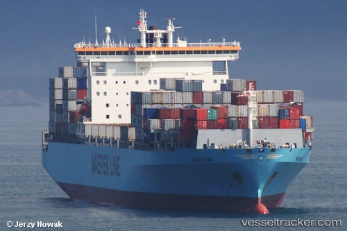
Vessel Ian H IMO: 9189500, MMSI: 636016980 Container Ship
UTC, 22.37853, 114.57663, course: 90, speed: 0
UTC, 22.37905, 114.57669, course: 109, speed: 0
2026-03-24 08:04:45 UTC, 22.37970, 114.57715, course: 131, speed: 0
Live Vessel Ian H Analytics (details, animations, etc.)
Live AIS position: UTC. 13 nm E of Wong Chuk Hang), updated 2026-03-24 08:04:45 UTC.Find the position of the vessel Ian H on the map. The latter are known coordinates and path.
marine traffic ship tracker show on live map
The current position of vessel Ian H is 22.37970 lat / 114.57715 lng. Updated: 2026-03-24 08:04:45 UTCDetails:
Last coordinates of the vessel:
UTC, 22.37798, 114.57671, course: 73, speed: 0UTC, 22.37853, 114.57663, course: 90, speed: 0
UTC, 22.37905, 114.57669, course: 109, speed: 0
2026-03-24 08:04:45 UTC, 22.37970, 114.57715, course: 131, speed: 0