 vesseltracker.com
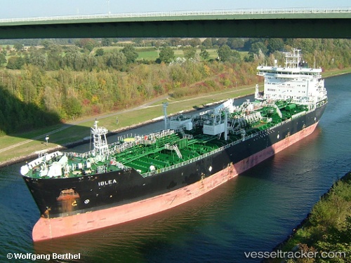
Vessel IBLEA IMO: 9244441, MMSI: 255916281 Oil/Chemical Tanker
UTC, 8.46274, -16.86837, course: 150, speed: 12
UTC, 8.06005, -16.61826, course: 144, speed: 11.9
2026-02-27 01:55:48 UTC, 7.76531, -16.41711, course: 146, speed: 12.5
Live AIS position:
UTC. 191 nm SW of Conakry),
updated 2026-02-27 01:55:48 UTC.
Find the position of the vessel IBLEA on the map. The latter are known coordinates and path.
marine traffic ship tracker show on live map
The current position of vessel IBLEA is 7.76531 lat / -16.41711 lng. Updated: 2026-02-27 01:55:48 UTCCurrently sailing under the flag of Portugal
Details:
Last coordinates of the vessel:
UTC, 8.83244, -17.12226, course: 143, speed: 12.2UTC, 8.46274, -16.86837, course: 150, speed: 12
UTC, 8.06005, -16.61826, course: 144, speed: 11.9
2026-02-27 01:55:48 UTC, 7.76531, -16.41711, course: 146, speed: 12.5